
Background layers
Add satellite imagery, weather, historical maps or your own WMS, WMTS, XYZ, TileJSON, ArcGIS or PMTiles service under your data.
On this page
Background layers draw a map service under your data: satellite imagery from yesterday, historical aerial photos, weather radar, hiking routes, or your own organization's WMS. They are fetched live from their publisher every time the map loads — nothing is uploaded, and they don't count towards your data limits.
A map can have up to 5 background layers. On a Compare map, each side has its own 5.
Add a layer
Select Layers on the map (on a Compare map, scroll to Background layers in a side's tab), then Add layer. The dialog has two tabs.
Browse layers
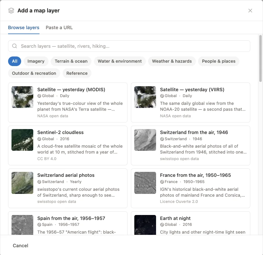
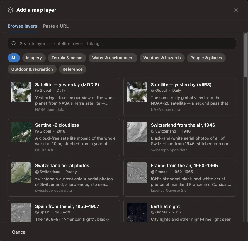
The catalog has 35 ready-made layers in seven categories. Search it or pick a category, then select a layer to add it. Every catalog layer may be used on commercial maps, and its credit is added to your map automatically. The full list is at the end of this page.
Paste a URL
Paste the address of a map service into Service URL and select Connect. Mapji checks the service, lists its layers, and lets you pick which to add.
| Service | What to paste |
|---|---|
| WMS | The service's address, for example https://example.com/geoserver/wms |
| WMTS | The service's address |
| ArcGIS | A MapServer or ImageServer address |
| TileJSON | The address of the TileJSON document |
| PMTiles | The address of a .pmtiles archive, with image or vector tiles |
| XYZ tiles | A tile template with {z}, {x} and {y} placeholders, for image or vector tiles |
The service must use HTTPS, publish its layers in Web Mercator (EPSG:3857), and allow browsers to load it from other websites (CORS). PMTiles hosts must also allow range requests. If a service fails one of these checks, the dialog says which one, before anything is added. When the service answers but has no tile at the spot it tests — it may only cover a small area — you can still choose Add it anyway.
Vector layers — from a vector PMTiles archive or vector tiles — are drawn in one color you choose: areas filled, lines and outlines solid, points as dots. Up to 8 of an archive's layers can be added as one background layer.
Manage layers
Each layer in the Layers panel has:
- an opacity slider
- show and hide
- the up and down arrows: the list order is the drawing order, and later layers draw on top
- the name, which you can select to rename
- remove
- settings, described next
Layer changes are saved with the editor's Save.
Layer settings
| Setting | What it does |
|---|---|
| Show at zoom | The zoom levels the layer appears at, from 0 to 24 |
| Service's last level | For a pasted image service: the deepest zoom it has tiles for. Past it, the map enlarges those tiles instead of requesting ones that don't exist. |
| Adjust | For image layers: Brightness, Contrast, Saturation and Hue, with Reset |
| Legend | Shown when the layer publishes one — some catalog layers, such as precipitation or population density, and pasted services that provide a legend |
| Credit | For a pasted service: the attribution shown in the map's corner. Most publishers require one — check the service's terms. Catalog layers bring their own. |
For a vector layer, select its color swatch in the list to change the color.
Where layers draw
Background layers sit directly below the basemap's labels: they cover its land, water, roads and buildings, while place names stay readable on top. Your own data always draws on top of them. 3D terrain shading, contour lines and 3D buildings also draw above background layers.
Layer catalog
Each catalog layer is fetched from its publisher whenever the map loads. Layers marked Community-run come from volunteer projects on donated servers: fine for everyday maps, but those projects ask very busy or commercial sites to host the tiles themselves. The daily satellite layers (MODIS and VIIRS), snow cover, and smoke and dust show yesterday's data.
| Layer | Coverage | Updated | License |
|---|---|---|---|
| Imagery | |||
| Satellite — yesterday (MODIS) | Global | Daily | NASA open data |
| Satellite — yesterday (VIIRS) | Global | Daily | NASA open data |
| Sentinel-2 cloudless | Global | 2016 | CC BY 4.0 |
| Switzerland from the air, 1946 | Switzerland | 1946 | swisstopo open data |
| Switzerland aerial photos | Switzerland | Yearly | swisstopo open data |
| France from the air, 1950–1965 | France | 1950–1965 | Licence Ouverte 2.0 |
| Spain from the air, 1956–1957 | Spain | 1956–1957 | CC BY 4.0 |
| Earth at night | Global | 2016 | NASA open data |
| Blue Marble with relief | Global | Static | NASA open data |
| Terrain & ocean | |||
| Hillshade | Global | Static | NASA open data |
| US shaded relief | United States | Static | Public domain (USGS) |
| US topographic map | United States | Ongoing | Public domain (USGS) |
| Ocean depth (GEBCO) | Global | Yearly | Public domain (GEBCO) |
| European seabed depth | European seas | Yearly | CC BY 4.0 |
| Water & environment | |||
| Surface water | Global | 1984–2021 | Copernicus open data |
| Tree cover loss | Global | Yearly | CC BY 4.0 |
| Land cover (Corine) | Europe | 2018 | Copernicus open data |
| Vegetation (NDVI) | Global | Monthly | NASA open data |
| Snow cover | Global | Daily | NASA open data |
| US rivers and lakes | United States | Ongoing | Public domain (USGS) |
| Weather & hazards | |||
| US weather radar | Contiguous US | Live | Public domain (NOAA) |
| Precipitation | Global | Daily | NASA open data |
| Sea surface temperature | Global oceans | Daily | NASA open data |
| Smoke & dust | Global | Daily | NASA open data |
| People & places | |||
| Population density | Global | 2020 | CC BY 4.0 |
| Administrative boundaries | Global | Monthly | ODbL / CDLA |
| Roads and paths | Global | Monthly | ODbL / CDLA |
| Places | Global | Monthly | ODbL / CDLA |
| Outdoor & recreation | |||
| Hiking routesCommunity-run | Global | Daily | CC BY-SA |
| Cycling routesCommunity-run | Global | Daily | CC BY-SA |
| Mountain-bike routesCommunity-run | Global | Daily | CC BY-SA |
| Bike infrastructureCommunity-run | Global | Daily | CC BY-SA |
| Ski pistesCommunity-run | Global | Daily | CC BY-SA |
| Sea marksCommunity-run | Global coasts | Daily | CC BY-SA |
| Reference | |||
| Coastlines | Global | Static | NASA open data |