
The map editor
A tour of the editor: the toolbar, the buttons on the map, the sidebar tabs for each map type, and the status bar.
On this page
Every map type opens in the same editor, so the same things are always in the same place. Only the contents of the sidebar change from type to type.
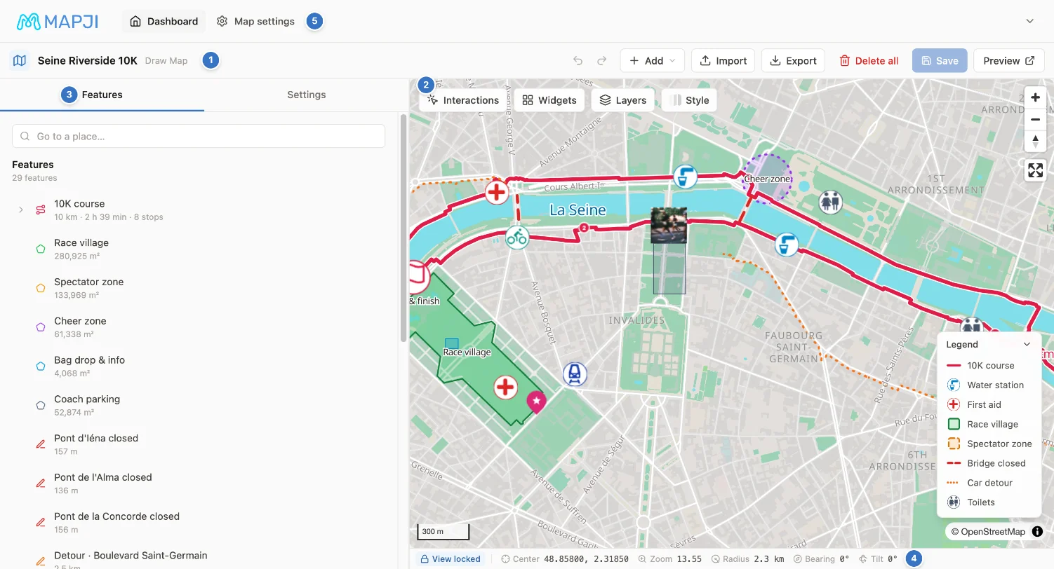
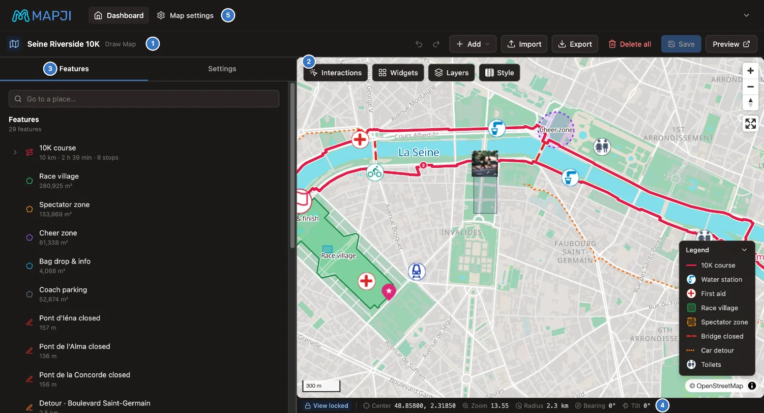
| Area | What it holds | |
|---|---|---|
| 1 | Toolbar | The map's name and type, the tools for adding data, Save, and Preview |
| 2 | Buttons on the map | Interactions, Widgets, Layers and Style |
| 3 | Sidebar | What is on the map, and the Settings for this map type |
| 4 | Status bar | Where the camera is, and the opening-view lock |
| 5 | Map settings | Name, access, domains, share image and embed code, on a separate page |
The map in the middle is a working preview: what you change shows on it straight away, exactly as visitors will see it once you save.
The toolbar
The left side shows the map's name and its type. The right side holds the actions, from left to right:
| Control | Shown on | What it does |
|---|---|---|
| Google Sheets status | Maps connected to a sheet | When the sheet was last checked, any problem with it, and Sync now |
| Undo, Redo, Add, Import, Export, Delete all | Draw | The drawing tools — see Draw |
| Import chapters (Import stops in a Travel Journal) | Story Map | Builds chapters from a file. A Travel Journal also has Import GPS track. |
| Import | Cluster, Heatmap, Choropleth, Store Locator, Time Slider | Adds a file, or connects a Google Sheet |
| Save | Every map | Writes your changes — see Saving changes |
| Preview | Every map | Opens the published map in a new tab |
| More actions | Cluster, Heatmap, Choropleth, Store Locator, Time Slider, once the map has data | Clear map data…, which permanently deletes the map's data after you confirm |
Isochrone and Compare maps add their data from the sidebar instead, and a Crowdsourced Map's data comes from its visitors.
Buttons on the map
Four buttons sit at the top left of the map. Each opens a panel; select the button again, or click anywhere outside the panel, to close it.
| Button | What it controls | More |
|---|---|---|
| Interactions | What visitors can do with the map: pan, zoom, rotate, use the keyboard | Interactions and widgets |
| Widgets | Which controls appear on the map: zoom buttons, compass, scale bar, search, export | Interactions and widgets |
| Layers | Background layers such as satellite imagery, weather or your own map service | Background layers |
| Style | The basemap, and map features such as terrain, 3D buildings and points of interest | Map styles |
A Compare map shows Interactions, Widgets and Style here. Its background layers are set per side, in each side's sidebar tab.
The sidebar
The sidebar has one tab for what is on the map and one for its settings. Map types with more to edit add their own tabs.
| Map type | Tabs |
|---|---|
| Draw, Cluster, Heatmap, Time Slider | Features · Settings |
| Choropleth | Selected areas · Settings |
| Isochrone | Starting points · Settings |
| Store Locator | Locations · Settings |
| Story Map | Chapters (Stops in a Travel Journal) · Settings |
| Crowdsourced Map | Pins · Area · Fields · Rules · Display |
| Compare | One tab per side, named after its label (Before and After to start with) · Settings |
On Cluster, Heatmap and Time Slider maps, Features is a read-only list for finding things: type in its filter box, and select a row to fly the map to that feature. It shows the first 200 rows, so on a large dataset use the filter rather than scrolling. A Draw map's Features list is where you edit the drawing instead — see Draw.
The Settings tab holds the options for the map type, followed by shared sections: the opening view on every type except Story Map, and on the types that support them, the popup and search and filters. On Cluster and Heatmap maps the type's own sections stay disabled until there is data to configure.
The status bar
The strip under the map reads out where the camera is, and updates as you move the map.


| Readout | Meaning |
|---|---|
| Lock view / View locked | Pins the current camera as the map's opening view. See Opening view. |
| Center | Latitude and longitude of the middle of the map. Select it to copy the coordinates. |
| Zoom | The current zoom level. |
| Radius | The distance from the center to the corner of the map, for a sense of scale. |
| Bearing | The rotation: 0° is north up. |
| Tilt | How far the map is tilted: 0° is straight down. |
When the view is locked and you move the map away from it, Update to current appears next to the lock and moves the locked view to where you are now. In a narrow window the readouts shrink to their icons.
Keyboard shortcuts
| Shortcut | Where | Action |
|---|---|---|
| ⌘ S or Ctrl S | Every editor | Save |
| ⌘ Z or Ctrl Z | Draw, Crowdsourced Map | Undo |
| ⌘ Shift Z, or Ctrl Y | Draw, Crowdsourced Map | Redo |
| Delete or Backspace | Draw | Delete the selected feature |
| Esc | Draw | Close the selected feature's panel, or cancel the route builder |
| ⌘ Enter or Ctrl Enter | Draw route builder | Add the route to the map |
The Draw shortcuts are ignored while you are typing in a field. Other map types add their own keys, such as stepping through Story Map chapters; their pages list them.
The dashboard thumbnail
The picture on each map's card in All Maps, which is also its preview image when the link is shared, is a screenshot the editor takes automatically: when you open the editor (at most once every few minutes) and when you save a change to the map's style. To use your own image instead, upload a Social share image under Map settings → Appearance; automatic screenshots then stop replacing it. See Map settings.